


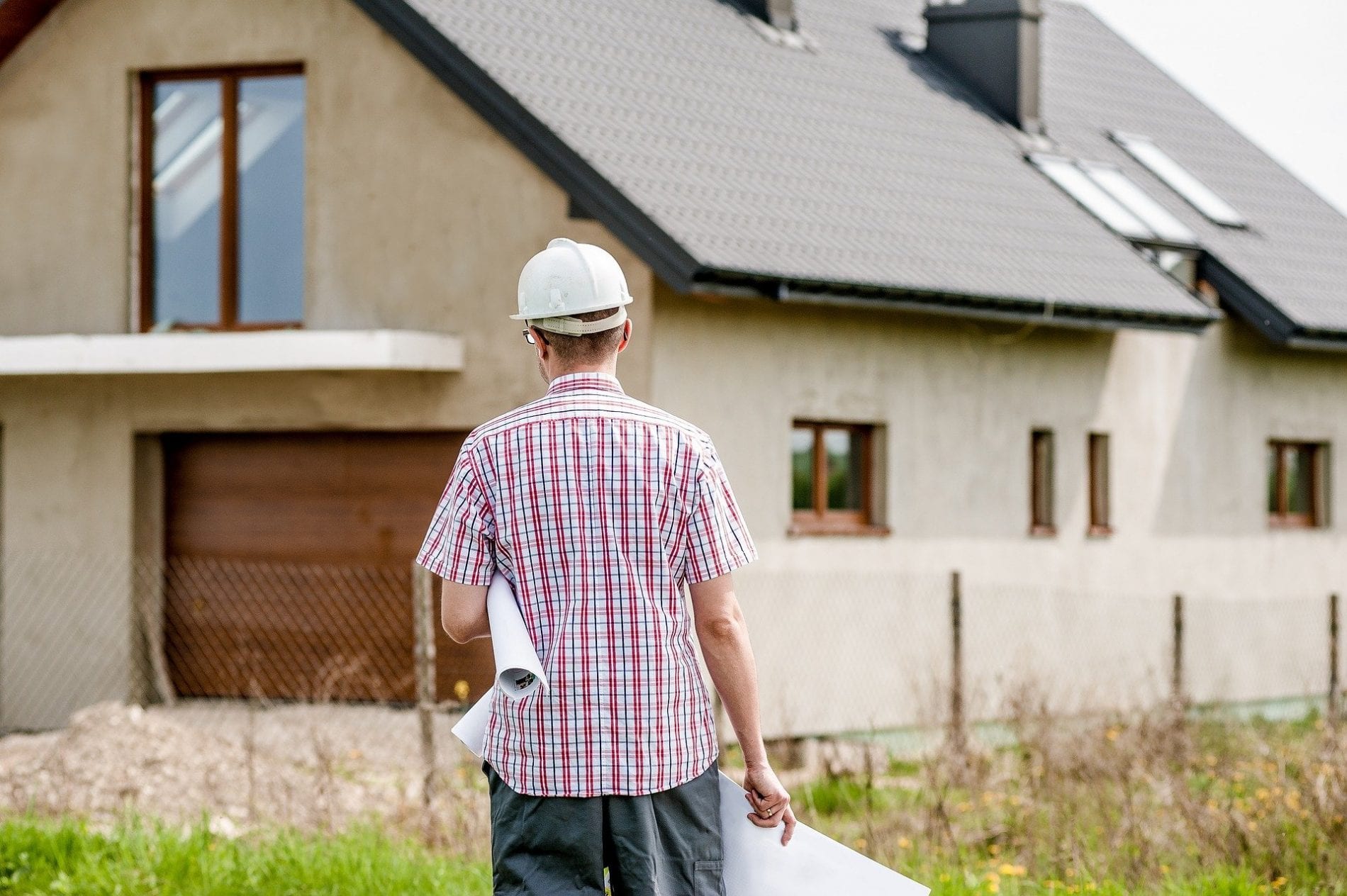
MORE THAN 1,600 homes have been approved by the borough council’s planning committee, marking the next big step for Wokingham’s local plan.
On Tuesday evening, the committee voted in favour of a range of proposals which will expand Wokingham south of the railway line.
The proposals form part of the South Wokingham Major Development, which will see 2,500 homes built in total, alongside two primary schools, new community facilities, parks and play areas, and the South Wokingham Distributor Road (SWDR).
The first phase of the development, north of the railway line, is already underway.
Thousands of homes to come
At Tuesday’s planning meeting, the committee approved two proposals which will see roughly 1,600 new homes built.
Split across two applications, the first proposal, also known as Phase 2a, proposed up to 215 dwellings in the east of the development, next to Bigwood House.
The second proposal, Phase 2b, called for an additional 1,434 homes north of Luckley Road and adjacent to the Tesco superstore on Finchampstead Road.
They will comprise 35% affordable housing, and have been described by council officers as “a high quality, sustainable extension to Wokingham”.
Alongside the houses, there will be public open space, play areas and landscaping.
Together, this will form a new urban centre, connected to the rest of Wokingham via the SWDR.
Criticising the proposals, Cllr Peter Dennis said the houses will “devastate” the town by blurring the boundary between Wokingham and Bracknell.
Cllr Stephen Conway added it puts Wokingham in danger of becoming “a massive urban sprawl”, leaving less than one km between the two towns.
Cllr Conway also questioned how the development will impact nearby Listed buildings.
“There are some really valuable buildings in or near these developments, which will all be quite profoundly affected,” he said.
“Appreciation of the environment and the value of green space has been highlighted during the pandemic and future generations won’t have the same rural setting we do.”
Emy Circuit, principal planning officer, said the development will “inevitably” impact any pre-existing buildings “to some degree”.
Despite no questions being raised about a possible GP surgery on site, Ms Circuit said the NHS Clinical Commissioning Group (CCG) is not considering a new centre at the moment so nothing has been included in the proposal — but there is a potential to offer outreach support.
Both proposals were approved unanimously by Wokingham Borough Council’s planning committee.
Support for the new community
A new primary school will also be built off Luckley Road, as part of Phase 2b of the development.
The two-form entry school will sit alongside a new Local Centre, described as a “community hub” offering a range of facilities, including a local food store.
Two areas of Suitable Alternative Greenspace (SANGs) will also be created, near the school and retail hub.
Cllr Pauline Jorgensen questioned why a secondary school had not been included in any of the proposals.
“The council said there would be capacity for secondary schools in 2020 and 2021, but what about following years?” she said. “If it takes two years to build a secondary school, why is it not part of the application now?”
But Ms Circuit said the council plans to begin developing the housing in a number of years, so a secondary school is not on the cards just yet.
Included within the proposal for the new homes, the facilities were also unanimously approved by the committee.
New highway sparks debate
The second phase of the SWDR is also going ahead after receiving approval from the planning committee.
The new, 30mph highway will travel from Waterloo Road, where it links with the first phase of the SWDR, through the new housing development and to the roundabout near the Tesco on Finchampstead Road.
The verges will be landscaped with a mix of diverse trees and grassland.
It will also be flanked by a 3-metre wide combined footpath and cycleway, which prompted a debate about sustainable travel to dominate the evening.
Cllr Maria Gee said the pathway will inevitably cause “conflict” between walkers, cyclists and motorists.
She said pedestrians will constantly be overtaken by those on bikes, and people do not want to be “caught unawares” on the side of a busy highway.
“Cyclists might then move onto the road and conflict with motorists,” she said. “It does not give a good message that walkers and cyclists are given much less space.
“Please think again and send this back for redesign to put non-motorists on equal footing.”
This was echoed by Wokingham borough resident Alex Cran and Cllr Dennis, who also objected to the design of the SWDR.
Mr Cran said the council has a “once in a lifetime opportunity to get things right” for the pathway.
“The council has set targets for reducing pollution, and addressing the climate emergency relies on people walking and cycling more,” he said. “This road has the potential to be an excellent route for lots of people to access the town centre, but it needs to be got right in the first place.”
Cllr Dennis also questioned whether the combined pathway would disadvantage the borough’s children.
“We need to encourage them to walk and cycle to school for their physical and mental health,” he said.
He added Wokingham Borough Council should “be brave, take initiative and demonstrate that [it] is taking the climate emergency seriously” by making changes to the proposal.
“Let’s make it easier for our community to adopt sustainable transport, at least for the shorter journeys.”
But Jean Malovi, speaking on behalf of the borough council, said separating the pathways would be impossible without growing the development by 15%.
“It would have both cost and time implications,” she said.
Judy Kelly, a council officer, said the combined pathway also has some benefits.
“You do not want to walk on one side of the track while your child cycles on the other side,” she said.
Connor Corrigan, service manager for planning and delivery, added that redesigning the road to take into account these concerns would have “huge cost implications” and could reduce the number of houses that could be built overall.
“If you pull down the numbers, those houses will go elsewhere with no infrastructure,” he said. “We’re talking about a major delay in years here.
“It’s not as simple as putting two metres on the side of the road.”
South Wokingham resident Fitzroy Morrisey also questioned if the SWDR would be safe from flooding.
Mr Morrisey, who lives near Luckley Brook, said his property was “severely” flooded earlier this year.
“There’s a history of flooding affecting nearby properties,” he said. “But [these incidents] have not been taken into account for this development.”
Chris Patmore, from WSP, said the Emm Brook should not be affected by any of the proposals.
A suggestion from Councillor Stephen Conway at the end of the meeting to defer the SWDR application was rejected by the committee.
Five members voted in favour of the new road and three against.
The SWDR forms part of Wokingham’s Major Highways Programme and the first phase, William Heelas Way, is already in place. Once the entire route is completed, it will link London Road to Finchampstead Road.
Homes to be destroyed for new roundabout
Two properties will also be flattened to install a new roundabout connecting Molly Millars Lane and Finchampstead Road, to support the extended SWDR.
Approved by the planning committee on Tuesday evening, the proposal, also known as the Western Gateway, intends to ease congestion as traffic flows onto the new highway.
It will see the mini roundabout at the end of Molly Millars Lane replaced with a larger structure.
The light-controlled pedestrian crossing on Finchampstead Road to the south of the roundabout will also be removed, and was going to be replaced with an uncontrolled island crossing.
But Ms Circuit said after scrutinising the proposal in detail, the council said it would not be safe and has promised to install a new controlled crossing near the entrance to Tangley Drive instead.
Adrian Betteridge, from Wokingham Active Travel Community Hub (WATCH), criticised the proposal for putting “vulnerable road users” at risk.
He said on average, 11 pedestrians and cyclists are killed or injured each week in the UK, and highlighted how the Western Gateway roundabout offers no safe cycling provisions on two of its three sides.
“Children walk and cycle to at least four different schools through this roundabout,” he said. “This design comprehensively fails … and cannot reasonably be considered adequate by any modern measure.”
He called for the roundabout’s design to be altered to offer more provisions for active travellers.
Cllr Sarah Kerr also spoke out against the Western Gateway and said it is “a failure on the council’s climate emergency commitments”.
“We will see an increase in poor air quality, which kills people,” she said. “”If you meant it when you voted for a climate emergency, you must turn this application down.”
But Ms Kelly said without the Western Gateway, the current roundabout at the end of Molly Millars Lane will be overwhelmed in the future.
“We need to do something at that junction, even if these developments don’t come forward,” she said.
Ms Malovi added the Western Gateway is essential to support the SWDR, and said it will improve what is on offer for walkers and cyclists, thanks to the new controlled crossing.
The committee approved the proposal, but not by a unanimous vote, on the condition that a toucan crossing will be installed near Tangley Drive.
Green space galore
Land to the south of St Anne’s Manor is also set to become a SANG as part of the wider development in South Wokingham.
On Tuesday evening, the planning committee approved a proposal which will see the land , which currently has a ‘nil use’ status, join with Buckhurst Meadows to create one larger open space.
The majority of the trees are set to remain on the 7.83 hectare site. A range of native shrubs will also be planted throughout, with woodland walks and meadow paths installed.
But Cllr Dennis criticised the site of the new park, which falls outside the boundary of the South Wokingham Strategic Development Location, saying it is “inappropriate”.
“It’s not in the [housing] development,” he said. “It’s also in an area where there are notable wildlife creatures, such as slowworms.”
Cllr Gee also raised concerns about whether the SANG would be accessible for residents living in the new dwellings.
“[The SANG] is separated from the new homes by a railway line, so residents using this would be from Montague Park,” she said. “This is great, but it doesn’t add to the facilities for the new residents.
“It will [also] be bordered by a railway and a major road. This is hardly the serene space most of us envisage when going on a walk.”
Supporting the proposal, Cllr Angus Ross said the SANG will be closer and more accessible to new residents than the Thames Basin Heath areas which people currently travel to.
Ms Circuit added that the three SANGs combined will give people a “generous” choice when going for walks.
The committee unanimously approved the proposal.
Finishing touches
The planning committee also approved a range of footpath changes, to further support the SWDR.
Residents can expect a new pathway, including a boardwalk and footbridge, over the Emm Brook, as well as a new footpath alongside the highway.
The walkways were criticised by Cllr Rachelle Shepherd-Dubey for combining footpaths and cycleways. She said walkers will have to “play dodgems” with cyclists.
Cllr Maria Gee also questioned whether the boardwalks would be suitable for wheelchair users in winter.
Andrew Fletcher, green infrastructure manager, said the applications met Wokingham Borough Council’s standards.
The committee unanimously voted for six pathway changes in total.
What is the local plan?
More than 10 years ago, Wokingham Borough Council launched its local plan to outline development in the borough until 2026.
As part of the plan, it suggested building roughly 2,500 new homes in South Wokingham in the hopes of concentrating development in one location, to protect “the character” of the borough’s other towns and villages.
Phase one of the local plan has already taken place in Montague Park, north of the railway, which includes a primary school, nature park and community orchard.
Now, work is due to start on the second phase, south of the railway, after receiving approval from the planning committee at Tuesday’s meeting.
It will include roughly 1,600 new homes, a second primary school, community facilities, parks and play areas, as well as the remainder of the SWDR.
Cllr Wayne Smith, executive member for planning and enforcement, said: “With these planning applications, our vision from 2010 is nearing completion — it is the last piece of the puzzle to create four self-contained new communities, each with the right infrastructure to serve its population.
“By carefully planning new development, we have been able to ensure developers pay for the roads, schools, parks and open spaces and community and sports facilities necessary for the new homes.”


